d
Home
Recreation
Biking
Boating
Camping
Fishing
Golfing
Hiking
Horseback Riding
Hunting
Swimming
Lodging
Attractions
Forest Park
Aquatic Center
Chautauqua Auditorium
General Dacey Trail
Historical Sites
Lincoln Eternal Flame
Shelby County Courthouse
Historical & Geneological Society
Shelbyville Public Library
Unique Attractions
Best Wedding Chapel
Chevy BelAir Museum
Goat Tower
Roxy Theatre
Thompson Mill Covered Bridge
Wineries
Niemberg Family Winery
Vahling Vineyards
Willow Ridge Vineyards & Winery
Event Calendar
Lincoln
On the Circuit
Abraham Lincoln Presidential Museum & Library
Looking for Lincoln
Statues
Area Maps
Guest Services
Contact Us
»Area Maps & Directions
Do you need directions to Lake Shelbyville? Just use the search function below!
Please enter starting address:
Example: 315 Main Street, Shelbyville, IL, 62565
Change Destination
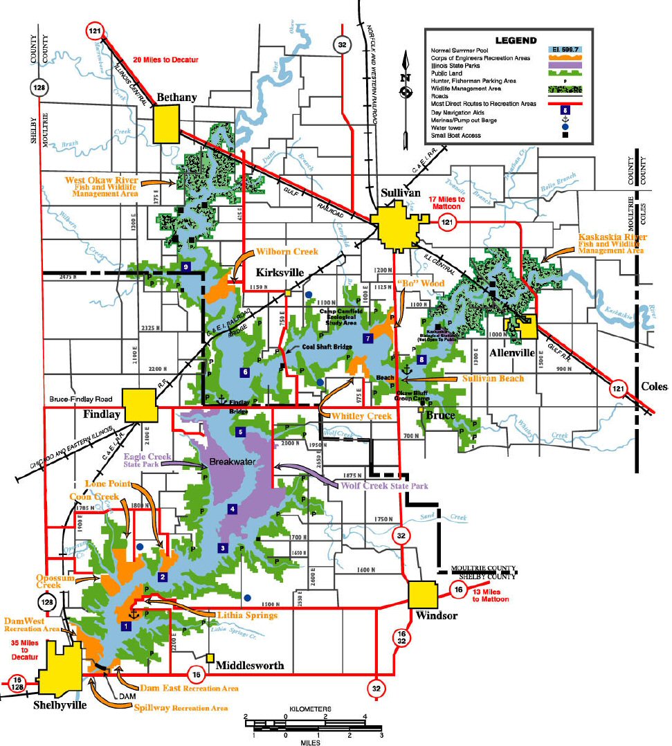
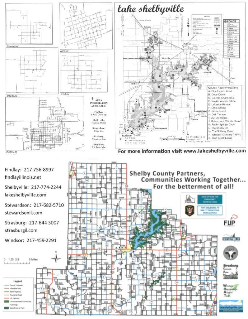
Click on lake map to enlarge
Get the latest maps of the lake area, and other various map-related downloads.
•
Area Map
•
Camp Camfield Trail Map
•
Location Map
•
General Dacey Trail Map
•
Illini Trail Map
•
Shelbyvlle Map
•
Shelby County/
Partner Map
